Hail Magic › Hail maps › Alabama
◆ ALABAMA HAIL HISTORY
Alabama hail map & storm history
Alabama has recorded 599 hail days in the past 5 years, with hail up to 6.00″ (Softball). Most recent: Sep 22, 2026. Browse 192 cities with hail reports.
✓ Data compiled by a degreed meteorologist from NOAA & NWS sources
599Hail days in the past 5 years
3.75″Largest ground report · Thortontown, May 20, 2025
6.00″Largest radar-estimated hail
192Cities with hail reports
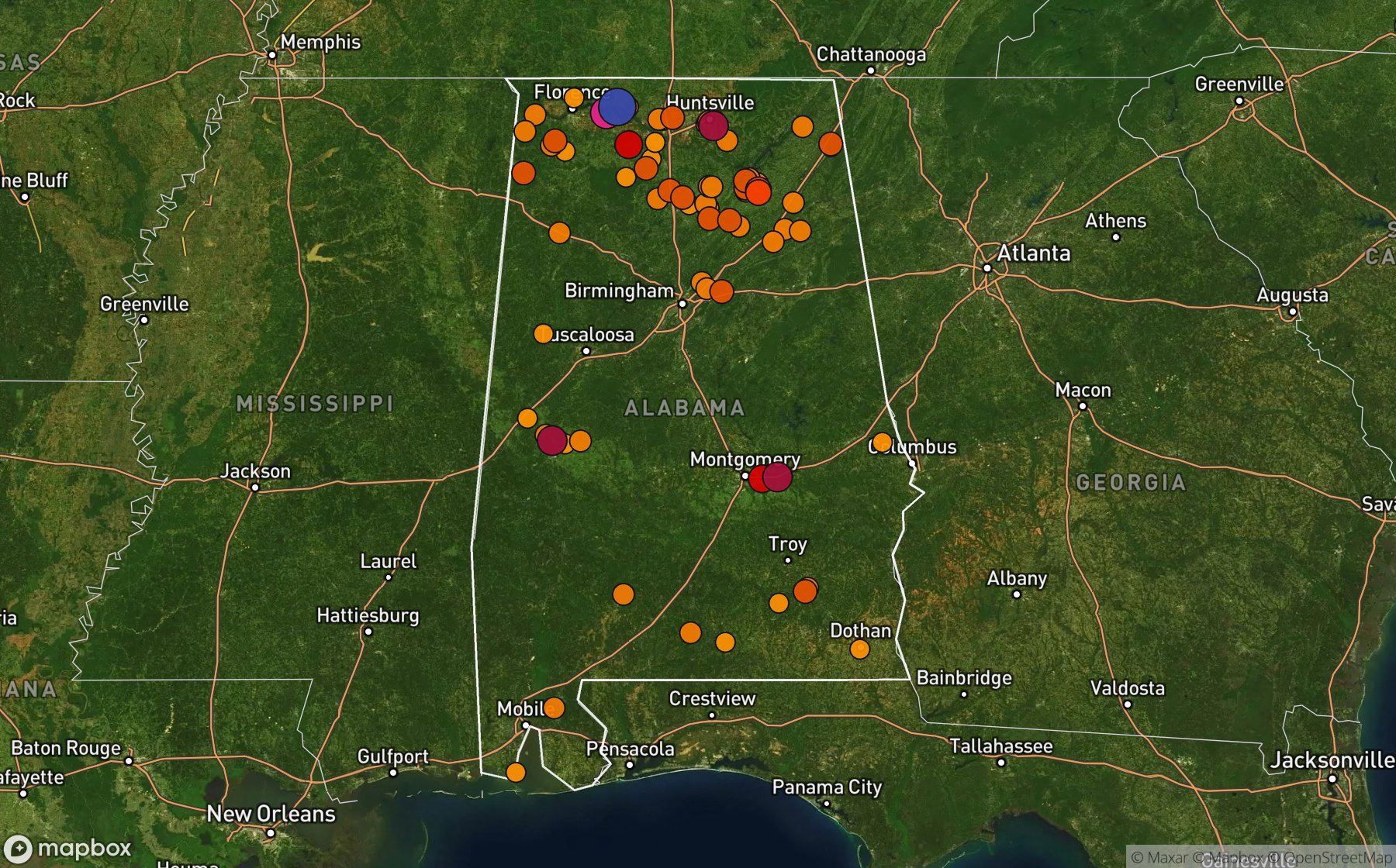
Largest NWS / NCEI hail reports across Alabama. Dot size and color show hail size.
Recent hail days in Alabama
| Date | Peak hail | Radar estimate | NWS reports |
|---|---|---|---|
| Sep 22, 2026 | 2.50″ | 2.50″ | — |
| Sep 21, 2026 | 2.00″ | 2.00″ | — |
| Sep 20, 2026 | 1.25″ | 1.25″ | — |
| Sep 19, 2026 | 2.00″ | 2.00″ | — |
| Sep 12, 2026 | 1.00″ | 1.00″ | — |
| Sep 11, 2026 | 1.25″ | 1.25″ | — |
| Sep 10, 2026 | 1.00″ | 1.00″ | — |
| Sep 8, 2026 | 0.75″ | 0.75″ | — |
| Sep 7, 2026 | 1.25″ | 1.25″ | — |
| Sep 6, 2026 | 1.25″ | 1.25″ | — |
| Sep 5, 2026 | 0.75″ | 0.75″ | — |
| Sep 4, 2026 | 0.75″ | 0.75″ | — |
| Sep 3, 2026 | 1.00″ | 1.00″ | — |
| Aug 30, 2026 | 0.75″ | 0.75″ | — |
| Aug 29, 2026 | 0.75″ | 0.75″ | — |
| Aug 28, 2026 | 1.00″ | 1.00″ | — |
| Aug 26, 2026 | 1.50″ | 1.50″ | — |
| Aug 25, 2026 | 0.75″ | 0.75″ | — |
| Aug 24, 2026 | 2.00″ | 2.00″ | — |
| Aug 23, 2026 | 1.00″ | 1.00″ | — |
| Aug 22, 2026 | 1.75″ | 1.75″ | — |
| Aug 21, 2026 | 6.00″ | 6.00″ | — |
| Aug 20, 2026 | 1.25″ | 1.25″ | — |
| Aug 19, 2026 | 1.25″ | 1.25″ | — |
| Aug 18, 2026 | 2.00″ | 2.00″ | — |
Most hail-hit cities
Hartselle (6), Huntsville Park (6), Griffin Addition (5), Albertville (4), Athens (4), Holly Pond (4), Madison (4), Caddo (3), Danville (3), Gladstone (3), Lattiwood (3), Nebo (3)
Hail history for every Alabama city (192)
(Hsv)Huntsville JoneAlabama PortAlbertvilleAlexandriaAlfalfaAltaAndersonArcolaAspelAthensAyresBabbieBaileytonBashamBear CreekBelkBerkleyBerlinBethelBlackburnBlountsvilleBluffBoazBoligeeBrannon StandBrooklynBryantBurgreen CornerBurnsvilleCaddoCentreChalkvilleChalybeate SpgsCherokeeCherrytreeChildersburgClarenceCoal VlyCorinthCottonwoodCrooked OakCrossroadsCubaDale County LakeDanvilleDetroitDothanDouble Spgs ArptEast GasdenEdenEldridgeElviraEthelsvilleFarleyFayetteFaysFive PtsFletcher ChapelForklandFosheeFrankfortFrench MillFruitdaleFt DavisGenevaGladstoneGordoGrand BayGreen HillGriffin AdditionGuinGuntersvilleHadenHaleyville Posey ArpHanoverHartselleHarvestHazel GreenHigh PtHokes BluffHollowayHolly PondHuntsville Mills ArpHuntsville ParkIrondaleJackJacksonburgJoppaKellys CrossroadsKilpatrickLakeviewLaneLattiwoodLeeLibertyLibertyvilleLily FlagLim RockLivingstonLomaxLongviewMadisonManchesterMarigoldMarktonMars HillMc CallaMillportMint SpgMityleneMonroevilleMoodyMorrisMountainviewMt CarmelMt MeigsMt ViewMynotNeboNew HopeNewburgNorth FlorenceOden RidgeOld Spring HillOliverOlympia Spa ResortOwens XrdsOzarkPaint RockParkwoodPaulPearces MillPeets CornerPetermanPeteyPike RoadPine LevelPinedalePiney GrovePisgahPleasant GrovePoolPulltightRabbit TownRed BankRedstone AafReedtownReeltownRehobethRice MillRoetonRoslieRussellvilleSalemSaratogaSardis SpgsScottsboroSealeSibertSidneySipseySouthsideSteelwoodStewerds StoreTaborTaylors CampTennilleThortontownTrianaTrussvilleTwinUnionUnion GroveUnion HillValley HeadVernonVictoriaVinaWadsworthWaughWellingtonWestWest PtWheeler Lake NorthWhiteheadWhitehouse ForksWhitsittWilliamsWinfieldWoodlawnWrenWynnville
Data window: NOAA MRMS radar hail swaths Oct 2021 – Nov 2026; NWS / NCEI Storm Events reports Nov 2024 – Jul 2026; CoCoRaHS volunteer reports Oct 2021 – present. Radar hail sizes are NOAA MRMS Maximum Estimated Size of Hail (MESH) and are estimates, not ground truth.