Hail Magic › Hail maps › Indiana
◆ INDIANA HAIL HISTORY
Indiana hail map & storm history
Indiana has recorded 340 hail days in the past 5 years, with hail up to 6.00″ (Softball). Most recent: Nov 12, 2026. Browse 215 cities with hail reports.
✓ Data compiled by a degreed meteorologist from NOAA & NWS sources
340Hail days in the past 5 years
4.00″Largest ground report · Sullivan, May 16, 2025
6.00″Largest radar-estimated hail
215Cities with hail reports
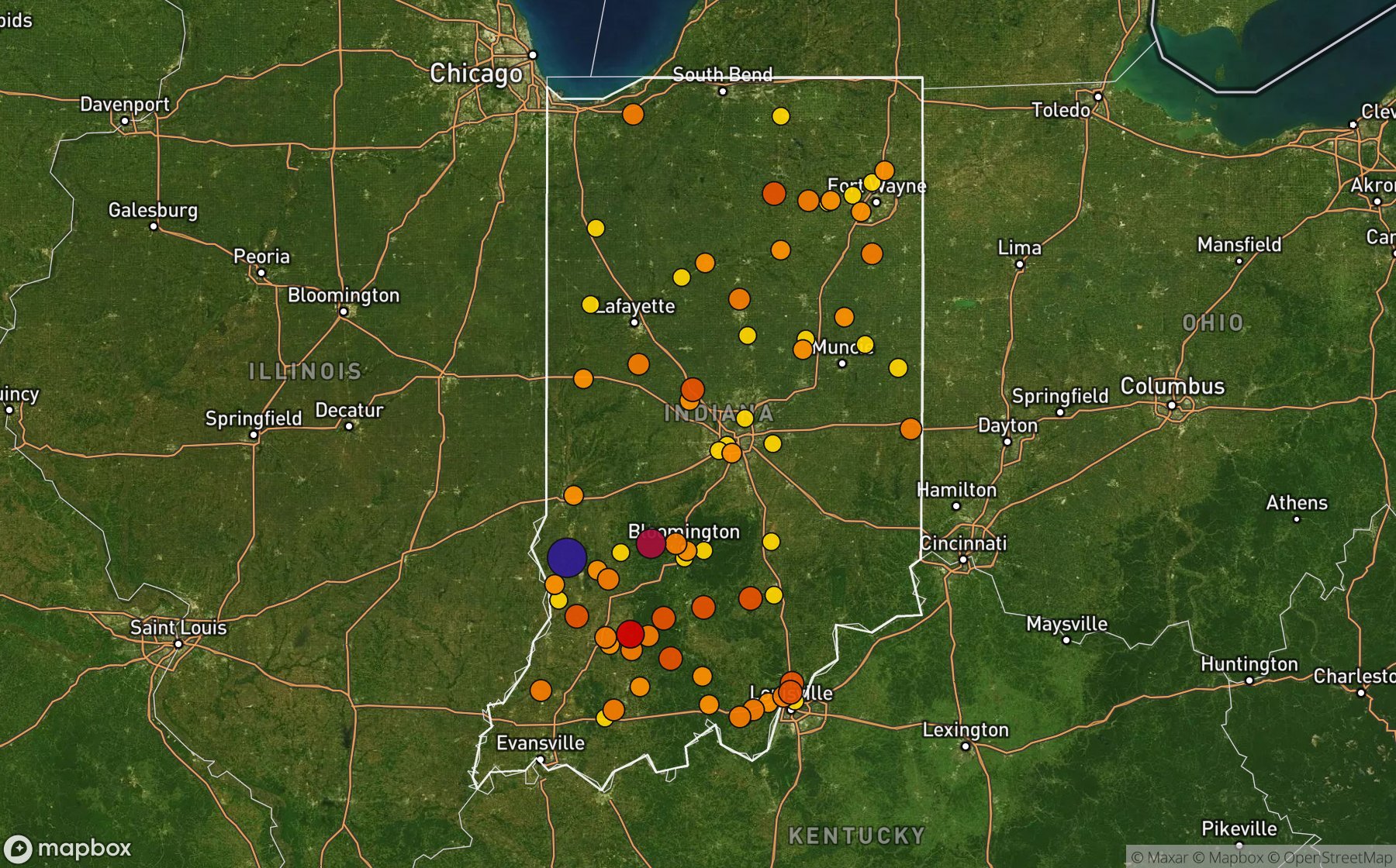
Largest NWS / NCEI hail reports across Indiana. Dot size and color show hail size.
Recent hail days in Indiana
| Date | Peak hail | Radar estimate | NWS reports |
|---|---|---|---|
| Nov 12, 2026 | 0.75″ | 0.75″ | — |
| Nov 11, 2026 | 1.75″ | 1.75″ | — |
| Nov 1, 2026 | 0.75″ | 0.75″ | — |
| Oct 27, 2026 | 2.25″ | 2.25″ | — |
| Oct 14, 2026 | 0.75″ | 0.75″ | — |
| Sep 21, 2026 | 0.75″ | 0.75″ | — |
| Sep 20, 2026 | 2.00″ | 2.00″ | — |
| Sep 18, 2026 | 1.75″ | 1.75″ | — |
| Sep 17, 2026 | 1.00″ | 1.00″ | — |
| Sep 16, 2026 | 1.25″ | 1.25″ | — |
| Sep 15, 2026 | 1.00″ | 1.00″ | — |
| Sep 10, 2026 | 0.75″ | 0.75″ | — |
| Sep 6, 2026 | 1.25″ | 1.25″ | — |
| Sep 5, 2026 | 1.00″ | 1.00″ | — |
| Sep 4, 2026 | 1.25″ | 1.25″ | — |
| Aug 31, 2026 | 1.25″ | 1.25″ | — |
| Aug 27, 2026 | 1.50″ | 1.50″ | — |
| Aug 26, 2026 | 1.25″ | 1.25″ | — |
| Aug 22, 2026 | 1.00″ | 1.00″ | — |
| Aug 20, 2026 | 0.75″ | 0.75″ | — |
| Aug 19, 2026 | 1.50″ | 1.50″ | — |
| Aug 17, 2026 | 1.50″ | 1.50″ | — |
| Aug 16, 2026 | 1.50″ | 1.50″ | — |
| Aug 14, 2026 | 1.75″ | 1.75″ | — |
| Aug 13, 2026 | 1.25″ | 1.25″ | — |
Most hail-hit cities
Cedarville (5), Bloomington (4), Corydon (4), Hartford City (4), Upland (4), Centerville (3), Loogootee (3), Paradise (3), Spencer (3), Sullivan (3), Summitville (3), Alexandria (2)
Hail history for every Indiana city (215)
(Okk)Kokomo Muni Arp(Rzl) Jasper County AirportAdelAlexandriaAllisonvilleAnderson Ace ArptArcolaAvonBakalar Muni ArptBeatriceBedfordBethanyBicknellBlack OakBlackiston MillBloomingdaleBloomingtonBlufftonBoonvilleBrambleBreckenridgeBremsBrownstownBrucevilleBurdickBurns CityCarlisleCarmelCassvilleCedar CanyonsCedarvilleCementvilleCentervilleClaypoolClear CreekClear SpgsClover VlgCoburgColumbia City ArptCommercial PlaceCorydonCritchfieldCurbyDecaturDemotteDenverDesotoDudleytownDuncanDunfeeDunkirkEagle VlgEagletownEast ColumbusEllettsvilleEllisonElnoraElstonErskinEwingFairviewFillmoreFive PtsFranklinFrentresstownFt Wayne Smith ArptGalvestonGatanantGlendaleGraveltonGreenbrierGreenfieldGreenhillHacklemanHanoverHaps ArptHarrisvilleHartford CityHaydenHazletonHenryvilleHighlandHobartHollandHooverHoveyHoweHuntersHuntingtonIndian SprsIndianapolis Intl ArJacksonsJamestownJeffersonvilleKennethKentlandKeystoneKingKingslandKirbyKirkpatrickKnightsvilleKokomoLaconiaLake CicottLake MillLanesvilleLawrenceLebanonLindenLintonLoogooteeLyonsMaltersvilleManillaMarengoMarshfieldMaywoodMilledgevilleMillhousenMilltownMonroviaMontmorencieMoroccoMt OliveMuncieNashvilleNew BethelNew FarmingtonNew MiddletownNew SalemNorth ManchesterNorth VernonOakland CityOaktownOssianOtiscoOxfordParadisePatricksburgPaynePeabodyPikevillePilot KnobPlainvillePleasant RidgePoseyvillePrentis CornersPrincetonRaberRaccoonRainesvilleRamseyRegoRenoRichmondRigdonRising SunRoanokeRockfieldSand PitScipioScott CityScottsburgSellersburgSelvinSevastopolSeymourShady HillsShipshewanaShoalsSilvervilleSleethSmith ValleySmithfieldSouth WhitleySouthwoodSpeedSpeedway ArptSpencerSpring LakeSt JohnStendalSterlingStevensonSullivanSummitvilleSunshine GardensTalmaTaswellTempletonTildenTowerTremontUplandValeeneVeedersburgVirgil Grissom ArptWabashWallenWarsawWashingtonWaterford MillsWawpecongWaynetownWest MuncieWestvilleWheatfieldWhitfieldWilliamsWinchesterWingateWoodridgeWorthingtonYoungs Creek
Data window: NOAA MRMS radar hail swaths Oct 2021 – Nov 2026; NWS / NCEI Storm Events reports Nov 2024 – Jul 2026; CoCoRaHS volunteer reports Oct 2021 – present. Radar hail sizes are NOAA MRMS Maximum Estimated Size of Hail (MESH) and are estimates, not ground truth.