Hail Magic › Hail maps › Kentucky
◆ KENTUCKY HAIL HISTORY
Kentucky hail map & storm history
Kentucky has recorded 362 hail days in the past 5 years, with hail up to 4.50″ (Softball). Most recent: Nov 12, 2026. Browse 245 cities with hail reports.
✓ Data compiled by a degreed meteorologist from NOAA & NWS sources
362Hail days in the past 5 years
4.50″Largest ground report · Gum Corners, May 16, 2025
4.50″Largest radar-estimated hail
245Cities with hail reports
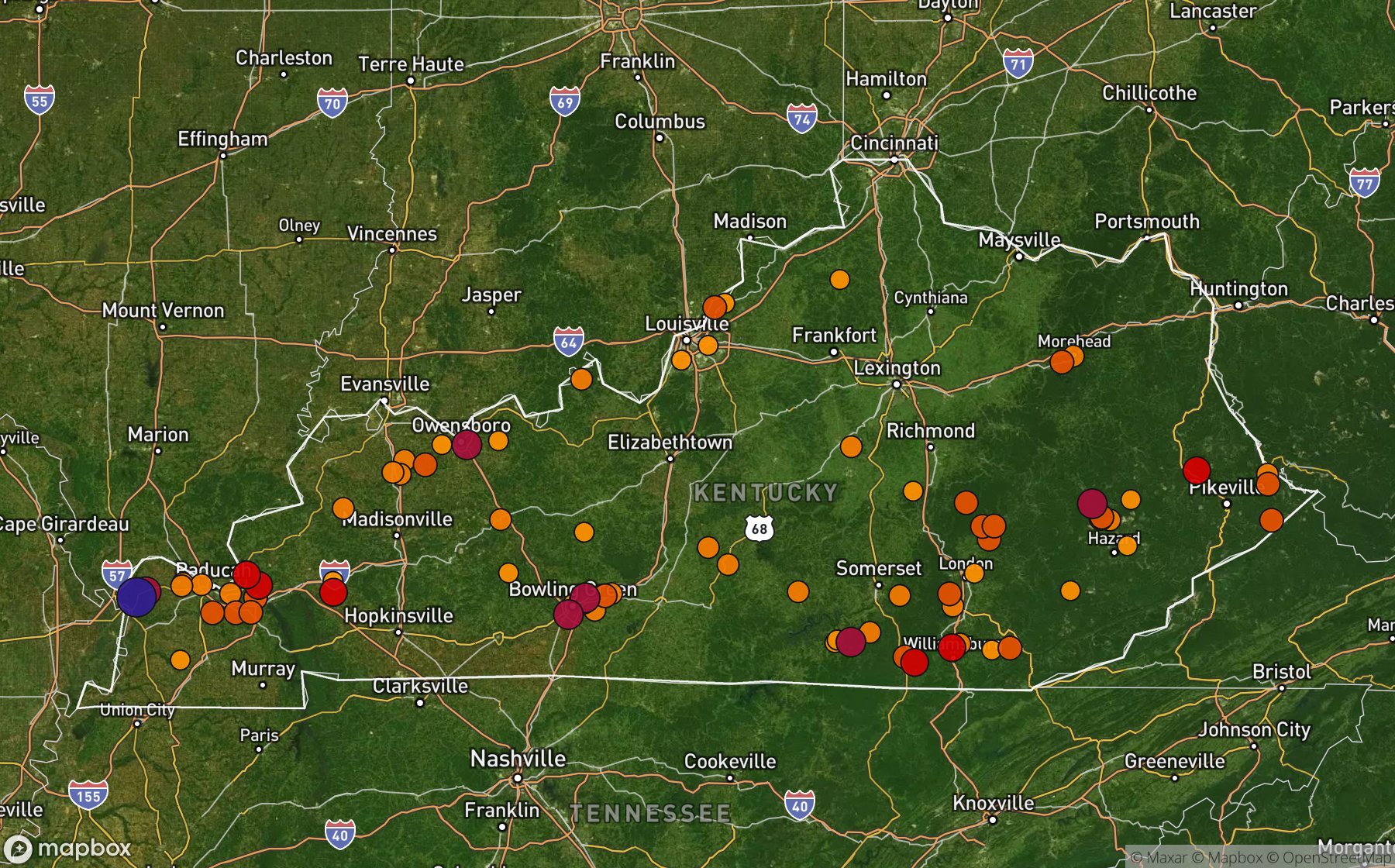
Largest NWS / NCEI hail reports across Kentucky. Dot size and color show hail size.
Recent hail days in Kentucky
| Date | Peak hail | Radar estimate | NWS reports |
|---|---|---|---|
| Nov 12, 2026 | 1.00″ | 1.00″ | — |
| Nov 11, 2026 | 1.75″ | 1.75″ | — |
| Oct 14, 2026 | 0.75″ | 0.75″ | — |
| Sep 22, 2026 | 1.50″ | 1.50″ | — |
| Sep 21, 2026 | 1.75″ | 1.75″ | — |
| Sep 20, 2026 | 1.00″ | 1.00″ | — |
| Sep 19, 2026 | 1.00″ | 1.00″ | — |
| Sep 18, 2026 | 1.00″ | 1.00″ | — |
| Sep 12, 2026 | 1.50″ | 1.50″ | — |
| Sep 11, 2026 | 1.25″ | 1.25″ | — |
| Sep 10, 2026 | 1.00″ | 1.00″ | — |
| Sep 6, 2026 | 2.00″ | 2.00″ | — |
| Sep 5, 2026 | 1.50″ | 1.50″ | — |
| Sep 4, 2026 | 1.50″ | 1.50″ | — |
| Aug 27, 2026 | 0.75″ | 0.75″ | — |
| Aug 26, 2026 | 0.75″ | 0.75″ | — |
| Aug 23, 2026 | 0.75″ | 0.75″ | — |
| Aug 22, 2026 | 1.75″ | 1.75″ | — |
| Aug 20, 2026 | 1.25″ | 1.25″ | — |
| Aug 17, 2026 | 1.75″ | 1.75″ | — |
| Aug 16, 2026 | 2.50″ | 2.50″ | — |
| Aug 15, 2026 | 1.00″ | 1.00″ | — |
| Aug 14, 2026 | 0.75″ | 0.75″ | — |
| Aug 13, 2026 | 1.00″ | 1.00″ | — |
| Aug 12, 2026 | 1.50″ | 1.50″ | — |
Most hail-hit cities
Bowling Green (5), Bristow (5), Monticello (4), Knottsville (3), Lawrenceburg (3), Leitchfield (3), Alvin (2), Clay (2), Goldbug (2), Greensburg (2), Heath (2), Horse Cave (2)
Hail history for every Kentucky city (245)
(Owb)Owensboro ArptAlexandriaAltonAlum SpgsAlvinAnnetaAsburyAsherAtkinsonAuburnBarbourvilleBaxterBeaver DamBeech GroveBelfryBentonBerkeleyBethanyBlack RockBloomfieldBluestoneBoldmanBonitaBoons CampBoscoBowling GreenBrandenburgBristowBroad BottomBrowns ForkBryants StoreBuena VistaBulanBurginBurkesvilleBushCadentownCalvert CityCampbellsvilleCamptonCanmerCartersvilleCayceCecilChalybeateClayClayholeClear Creek SpgsCliffCliftyColvilleComerConklingCooperCostelowCubaCutshinCynthianaDalloDarforkDavisvilleDawson SpgsDeatsvilleDecoyDeltaDentDoyleDublinEast BernstadtElk HornElk Horn CityEngleEoliaErlangerEssieEuterpeExieFancy FarmFedscreekFern CreekFistyForakerFosterFourmileGabeGarrettGilreathGirkinGoinsGoldbugGoodnightGoshenGottsGraceyGrahamvilleGrandviewGreearGreensburgGreenwoodGrethelGrigsbyGum CornersHadleyHardmoneyHardshellHawesvilleHawthorneHazardHazel GreenHeathHerbertHickoryHighland ParkHightopHighviewHippoHollonvilleHopewellHorntownHorse CaveHueys CornerHuffIndependenceIrvingtonJericoJohnsonvilleKeatonKeavyKellyKimperKingstonKirkmansvilleKnottsvilleKragonKuttawaLa CenterLackeyLawrenceburgLebanonLedbetterLeitchfieldLetitiaLexingtonLittle TexasLone OakLost CreekLothairLouisvilleLowesLowmansvilleMaple MtMaplesvilleMarshes SidingMasonvilleMayfieldMc AfeeMc AndrewsMc GowanMeeceMemphis JctMetaMiddlesboroMidwayMonticelloMonticello Wayne ArpMoreheadMorganfieldMt WashingtonMurrayNazarethNedNewbernOak GroveOak LevelOaklandOhioriver OrdinanceOwensboroOwentonPalmaParkwoodPegPembrokePendletonPikevillePleasant Green HillPodPovertyPrestonsburgPrincetonRenderRhodeliaRio VistaRockholdsRodburnRose HillRosettaSand HillSandgapSebreeSharerSharpeShrewsburySilver CitySimpsonvilleSkylightSlate LickSlickwaySmithlandSmiths GroveSmyrnaSorghoSouthSouth ColumbusSouth ElkhornSpannSprout SpgsSt CharlesSt MatthewsSt Regis ParkStacyStamping GroundStanleySullivanSylvaniaTaftTaylorsvilleThurstonTingTinsleyTrosperTynerUlyssesUnionVileyWabdWater VlyWebbs XrdsWeirWelchburgWest ViolaWestportWickliffeWilhurstWilliamsburg ArptWolf Creek
Data window: NOAA MRMS radar hail swaths Oct 2021 – Nov 2026; NWS / NCEI Storm Events reports Nov 2024 – Jul 2026; CoCoRaHS volunteer reports Oct 2021 – present. Radar hail sizes are NOAA MRMS Maximum Estimated Size of Hail (MESH) and are estimates, not ground truth.