Hail Magic › Hail maps › Massachusetts
◆ MASSACHUSETTS HAIL HISTORY
Massachusetts hail map & storm history
Massachusetts has recorded 54 hail days in the past 5 years, with hail up to 2.00″ (Golf Ball). Most recent: Aug 8, 2026. Browse 15 cities with hail reports.
✓ Data compiled by a degreed meteorologist from NOAA & NWS sources
54Hail days in the past 5 years
1.50″Largest ground report · Rockland, Aug 14, 2025
2.00″Largest radar-estimated hail
15Cities with hail reports
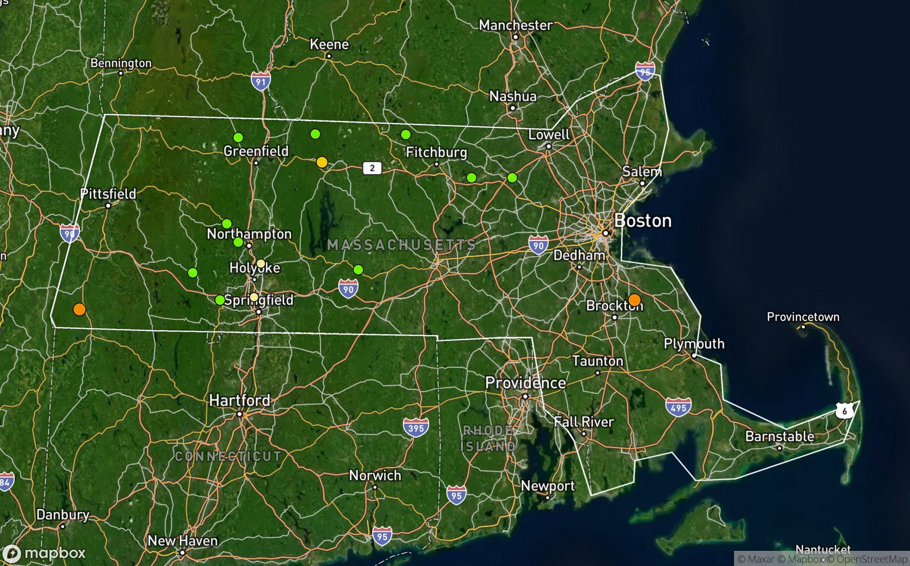
Largest NWS / NCEI hail reports across Massachusetts. Dot size and color show hail size.
Recent hail days in Massachusetts
| Date | Peak hail | Radar estimate | NWS reports |
|---|---|---|---|
| Aug 8, 2026 | 0.75″ | 0.75″ | — |
| Jul 19, 2026 | 1.00″ | 1.00″ | — |
| Jul 2, 2026 | 1.00″ | 1.00″ | — |
| Jun 6, 2026 | 0.75″ | 0.75″ | — |
| May 19, 2026 | 0.75″ | 0.75″ | — |
| Sep 6, 2025 | 1.50″ | 1.50″ | 4 |
| Aug 15, 2025 | 1.00″ | 1.00″ | — |
| Aug 14, 2025 | 1.50″ | 1.50″ | 1 |
| Aug 13, 2025 | 1.00″ | 1.00″ | — |
| Jul 20, 2025 | 0.75″ | 0.75″ | — |
| Jul 8, 2025 | 0.75″ | 0.75″ | — |
| Jul 4, 2025 | 0.75″ | 0.75″ | — |
| Jun 6, 2025 | 1.50″ | 1.50″ | 8 |
| May 17, 2025 | 1.00″ | 1.00″ | 1 |
| May 8, 2025 | 1.00″ | — | 1 |
| Jan 30, 2025 | 0.75″ | 0.75″ | — |
| Aug 26, 2024 | 2.00″ | 2.00″ | — |
| Aug 15, 2024 | 1.25″ | 1.25″ | — |
| Aug 2, 2024 | 1.00″ | 1.00″ | — |
| Jul 17, 2024 | 1.50″ | 1.50″ | — |
| Jul 16, 2024 | 1.00″ | 1.00″ | — |
| Jul 15, 2024 | 1.00″ | 1.00″ | — |
| Jul 9, 2024 | 1.00″ | 1.00″ | — |
| Jun 22, 2024 | 1.50″ | 1.50″ | — |
| Jun 21, 2024 | 1.00″ | 1.00″ | — |
Most hail-hit cities
Aldenville (1), Bay State (1), Colrain (1), Huntington (1), Littleton Common (1), North Ashburnham (1), Orange (1), Rockland (1), Searsville (1), Sheffield (1), Shirley (1), South Hadley (1)
Hail history for every Massachusetts city (15)
AldenvilleBay StateColrainHuntingtonLittleton CommonNorth AshburnhamOrangeRocklandSearsvilleSheffieldShirleySouth HadleyWarwickWest BrookfieldWestfield
Data window: NOAA MRMS radar hail swaths Oct 2021 – Nov 2026; NWS / NCEI Storm Events reports Nov 2024 – Jul 2026; CoCoRaHS volunteer reports Oct 2021 – present. Radar hail sizes are NOAA MRMS Maximum Estimated Size of Hail (MESH) and are estimates, not ground truth.