Hail Magic › Hail maps › Maine
◆ MAINE HAIL HISTORY
Maine hail map & storm history
Maine has recorded 709 hail days in the past 5 years, with hail up to 6.00″ (Softball). Most recent: Nov 10, 2026. Browse 8 cities with hail reports.
✓ Data compiled by a degreed meteorologist from NOAA & NWS sources
709Hail days in the past 5 years
1.50″Largest ground report · Clayton Lake, Jul 3, 2025
6.00″Largest radar-estimated hail
8Cities with hail reports
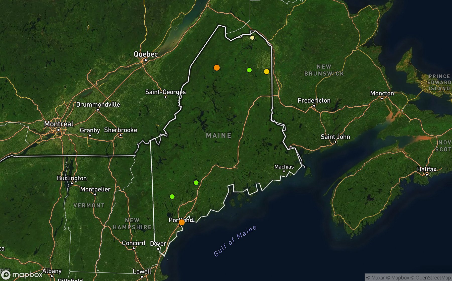
Largest NWS / NCEI hail reports across Maine. Dot size and color show hail size.
Recent hail days in Maine
| Date | Peak hail | Radar estimate | NWS reports |
|---|---|---|---|
| Nov 10, 2026 | 1.00″ | 1.00″ | — |
| Nov 9, 2026 | 1.00″ | 1.00″ | — |
| Nov 6, 2026 | 0.75″ | 0.75″ | — |
| Nov 4, 2026 | 0.75″ | 0.75″ | — |
| Nov 2, 2026 | 0.75″ | 0.75″ | — |
| Nov 1, 2026 | 0.75″ | 0.75″ | — |
| Oct 31, 2026 | 0.75″ | 0.75″ | — |
| Oct 30, 2026 | 1.75″ | 1.75″ | — |
| Oct 29, 2026 | 2.00″ | 2.00″ | — |
| Oct 28, 2026 | 1.50″ | 1.50″ | — |
| Oct 26, 2026 | 1.25″ | 1.25″ | — |
| Oct 25, 2026 | 3.25″ | 3.25″ | — |
| Oct 23, 2026 | 3.00″ | 3.00″ | — |
| Oct 22, 2026 | 1.00″ | 1.00″ | — |
| Oct 21, 2026 | 2.50″ | 2.50″ | — |
| Oct 20, 2026 | 1.00″ | 1.00″ | — |
| Oct 19, 2026 | 1.50″ | 1.50″ | — |
| Oct 15, 2026 | 1.00″ | 1.00″ | — |
| Oct 12, 2026 | 1.50″ | 1.50″ | — |
| Oct 10, 2026 | 1.00″ | 1.00″ | — |
| Oct 9, 2026 | 0.75″ | 0.75″ | — |
| Oct 8, 2026 | 0.75″ | 0.75″ | — |
| Oct 7, 2026 | 1.00″ | 1.00″ | — |
| Oct 6, 2026 | 0.75″ | 0.75″ | — |
| Oct 5, 2026 | 0.75″ | 0.75″ | — |
Most hail-hit cities
Ashland (1), Belgrade (1), Clayton Lake (1), Easton (1), Falmouth (1), South Paris (1), St Agatha (1), Westfield (1)
Hail history for every Maine city (8)
Data window: NOAA MRMS radar hail swaths Oct 2021 – Nov 2026; NWS / NCEI Storm Events reports Nov 2024 – Jul 2026; CoCoRaHS volunteer reports Oct 2021 – present. Radar hail sizes are NOAA MRMS Maximum Estimated Size of Hail (MESH) and are estimates, not ground truth.