Hail Magic › Hail maps › North Carolina
◆ NORTH CAROLINA HAIL HISTORY
North Carolina hail map & storm history
North Carolina has recorded 439 hail days in the past 5 years, with hail up to 6.00″ (Softball). Most recent: Sep 30, 2026. Browse 154 cities with hail reports.
✓ Data compiled by a degreed meteorologist from NOAA & NWS sources
439Hail days in the past 5 years
2.50″Largest ground report · Stokes, May 15, 2025
6.00″Largest radar-estimated hail
154Cities with hail reports
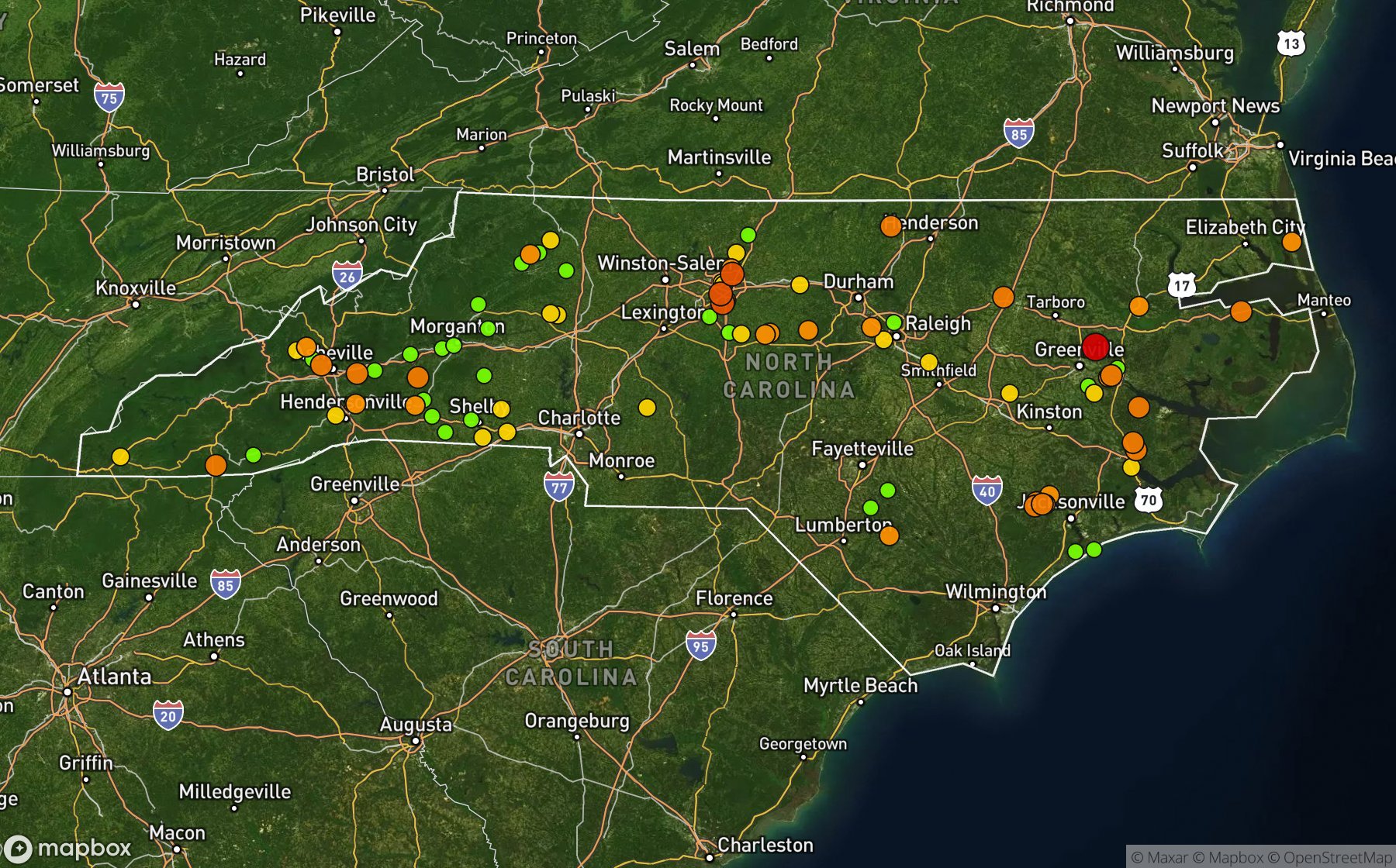
Largest NWS / NCEI hail reports across North Carolina. Dot size and color show hail size.
Recent hail days in North Carolina
| Date | Peak hail | Radar estimate | NWS reports |
|---|---|---|---|
| Sep 30, 2026 | 0.75″ | 0.75″ | — |
| Sep 22, 2026 | 1.00″ | 1.00″ | — |
| Sep 21, 2026 | 1.50″ | 1.50″ | — |
| Sep 20, 2026 | 0.75″ | 0.75″ | — |
| Sep 18, 2026 | 1.25″ | 1.25″ | — |
| Sep 17, 2026 | 0.75″ | 0.75″ | — |
| Sep 11, 2026 | 1.50″ | 1.50″ | — |
| Sep 6, 2026 | 1.25″ | 1.25″ | — |
| Sep 5, 2026 | 2.50″ | 2.50″ | — |
| Sep 4, 2026 | 2.25″ | 2.25″ | — |
| Sep 3, 2026 | 0.75″ | 0.75″ | — |
| Sep 2, 2026 | 1.25″ | 1.25″ | — |
| Aug 29, 2026 | 0.75″ | 0.75″ | — |
| Aug 28, 2026 | 1.00″ | 1.00″ | — |
| Aug 27, 2026 | 1.00″ | 1.00″ | — |
| Aug 24, 2026 | 1.75″ | 1.75″ | — |
| Aug 23, 2026 | 0.75″ | 0.75″ | — |
| Aug 22, 2026 | 1.00″ | 1.00″ | — |
| Aug 21, 2026 | 1.75″ | 1.75″ | — |
| Aug 20, 2026 | 1.25″ | 1.25″ | — |
| Aug 18, 2026 | 1.00″ | 1.00″ | — |
| Aug 17, 2026 | 1.00″ | 1.00″ | — |
| Aug 16, 2026 | 1.50″ | 1.50″ | — |
| Aug 15, 2026 | 0.75″ | 0.75″ | — |
| Aug 14, 2026 | 1.25″ | 1.25″ | — |
Most hail-hit cities
Broadview (3), Dortches (3), Macedonia (3), Whiteville (3), (Oaj)Ellis Fld Jacks (2), Abbottsburg (2), Alexander Mills (2), Battle Ground (2), Chapel Hill (2), Cherryville (2), Drexel (2), Easonburg (2)
Hail history for every North Carolina city (154)
(Oaj)Ellis Fld JacksAbbottsburgAcorn HillAlexanderAlexander MillsAltonAnderson CreekAsburyAydlettBald MtnBarium SpgsBattle GroundBertieBethlehemBlack MtnBlounts Creek StatioBrightwaterBroadviewBrookhavenBrowns SummitBurnsvilleCashiersCedar CreekChapel HillCharlotteCherryvilleChina Grove ArptChinquapin Fntn ArptClayton Flowers ArptCliffsideClingmanColumbiaCordovaCraggyCullowheeDaddysvilleDavistownDeep GapDobsonDortchesDrexelDruid HillsDuartDublinDunnDysortvilleEarlEasonburgEcho HgtsEdgemontEdneyvilleFergusonFeroFingerFlat RockFountainFruitlandGastonia ArptGlen AlpineGlenolaGrays ChapelGreensboro Arhrbr ArGregory ForksGrimeslandGroomtownGrovestoneHastyHayesvilleHaysHiddeniteHill TopHollemans XrdsHoodswampIndian TrailKannapolisKings MtnLawndale JctLeicesterLibertyLittle SwitzerlandLocustLoganLowes GroveLuckMacedoniaManteoMarbleMarionMatthewsMc CullersMc Gowans XrdsMebaneMebane Hurdle Fld ArMill SpgMillers CreekMills RiverMooresboroMorgantonMorrisvilleMulberryNeboNew HopeNorth WilkesboroOak ForestOlympiaOnslow BeachOttoOyamaPattersonPet XrdsPocomokePolkvilleProvidencePumpkin CenterRed HillReeseReidsvilleRexRollinsRutherfordtonSalemSandymushSatterwhiteSaw MillsShelmerdineSiler CitySilk HopeSmythSneads FerrySouth GastoniaSouth WhitevilleSouthern Pines ArptSpring HopeStaleyStatesville Rhyne ArStokesTerra CottaTerrellsTexanaThurmanTolucaTraphillTullsVanceboroVolgaWalkers StoreWarriorWashington ArptWest AshevilleWestryWhartonWhitevilleWilders GroveWoodley
Data window: NOAA MRMS radar hail swaths Oct 2021 – Nov 2026; NWS / NCEI Storm Events reports Nov 2024 – Jul 2026; CoCoRaHS volunteer reports Oct 2021 – present. Radar hail sizes are NOAA MRMS Maximum Estimated Size of Hail (MESH) and are estimates, not ground truth.