Hail Magic › Hail maps › New York
◆ NEW YORK HAIL HISTORY
New York hail map & storm history
New York has recorded 1,121 hail days in the past 5 years, with hail up to 6.00″ (Softball). Most recent: Nov 14, 2026. Browse 98 cities with hail reports.
✓ Data compiled by a degreed meteorologist from NOAA & NWS sources
1,121Hail days in the past 5 years
2.75″Largest ground report · Hermon, Jul 15, 2026
6.00″Largest radar-estimated hail
98Cities with hail reports
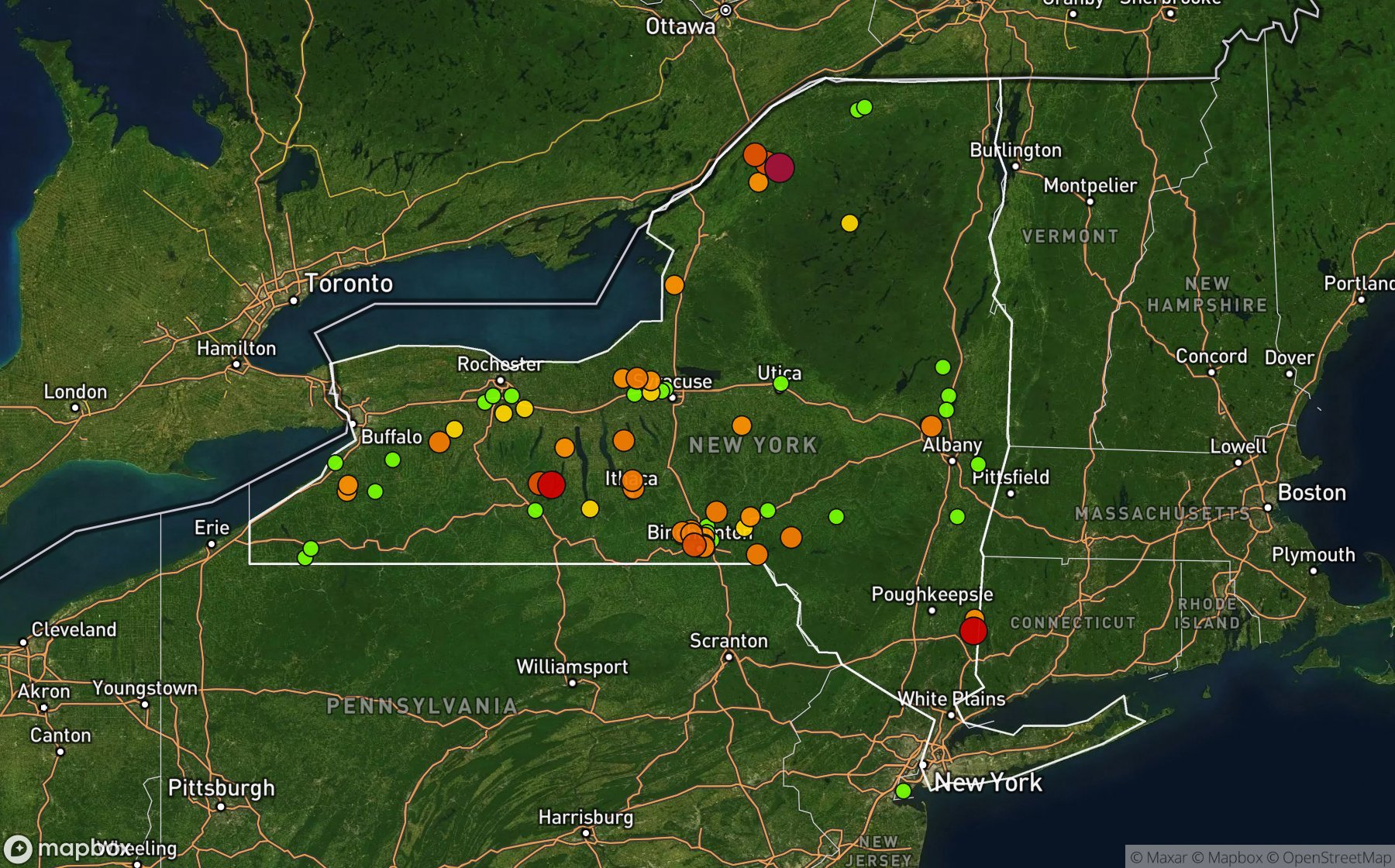
Largest NWS / NCEI hail reports across New York. Dot size and color show hail size.
Recent hail days in New York
| Date | Peak hail | Radar estimate | NWS reports |
|---|---|---|---|
| Nov 14, 2026 | 2.00″ | 2.00″ | — |
| Nov 13, 2026 | 2.00″ | 2.00″ | — |
| Nov 12, 2026 | 2.25″ | 2.25″ | — |
| Nov 10, 2026 | 1.00″ | 1.00″ | — |
| Nov 9, 2026 | 1.75″ | 1.75″ | — |
| Nov 8, 2026 | 3.50″ | 3.50″ | — |
| Nov 7, 2026 | 1.50″ | 1.50″ | — |
| Nov 6, 2026 | 1.50″ | 1.50″ | — |
| Nov 5, 2026 | 1.00″ | 1.00″ | — |
| Nov 4, 2026 | 1.75″ | 1.75″ | — |
| Nov 3, 2026 | 0.75″ | 0.75″ | — |
| Nov 1, 2026 | 1.25″ | 1.25″ | — |
| Oct 31, 2026 | 1.00″ | 1.00″ | — |
| Oct 29, 2026 | 1.75″ | 1.75″ | — |
| Oct 28, 2026 | 1.00″ | 1.00″ | — |
| Oct 26, 2026 | 1.25″ | 1.25″ | — |
| Oct 25, 2026 | 1.75″ | 1.75″ | — |
| Oct 24, 2026 | 2.00″ | 2.00″ | — |
| Oct 22, 2026 | 1.50″ | 1.50″ | — |
| Oct 21, 2026 | 1.50″ | 1.50″ | — |
| Oct 19, 2026 | 1.25″ | 1.25″ | — |
| Oct 18, 2026 | 1.25″ | 1.25″ | — |
| Oct 17, 2026 | 0.75″ | 0.75″ | — |
| Oct 16, 2026 | 4.00″ | 4.00″ | — |
| Oct 14, 2026 | 2.50″ | 2.50″ | — |
Most hail-hit cities
Binghamton (5), Avon (4), Cato (3), Jamestown (3), Prattsburg (3), Stella (3), (Bgm)Binghamton Arpt (2), Ashford Hollow (2), Canisteo (2), Gouverneur Arpt (2), Lakeland (2), Maine (2)
Hail history for every New York city (98)
(Bgm)Binghamton ArptAftonAngolaAshford HollowAuroraAvocaAvonBainbridgeBathBellevilleBentonBinghamtonBovina CenterBrushtonBurdettBustiCanisteoCatoChenango BridgeChenango FallsChoconut CenterChurubuscoCollinsCovingtonDe KalbDe PeysterDeerfieldDepositEast AvonEast GlenvilleEast LineEllisburgFawn RidgeGibson LndgGlass LakeGlenville CenterGouverneur ArptGreat KillsGreeneGrove SpgsHelmuthHermonHollandHoneoye Falls ArptHorseshoeHudson Co ArptJamestownJohnson CityJordanKattlevilleKennedyKettellvilleKingstonLakelandLakeville Hannas ArpLimaLong Branch ManorMaineMalvic ManorMayfieldMc Kinneys PtMerrifieldMoiraMontour FallsPackwood CornersPalmerPark TerracePecksportPerrysburgPittsfordPlainvillePort CranePort DickinsonPrattsburgPulteneyQuaker HillRhinebeckSaratoga SpgsScottsvilleSeneca FallsSheldon CornersShortsvilleSinclairvilleSouth BradfordSouth LansingStellaSullivanUnadillaVictorWaltonWarnersWarsawWayneWebatuckWest AlmondWest CoxsackieWest HenriettaWilton
Data window: NOAA MRMS radar hail swaths Oct 2021 – Nov 2026; NWS / NCEI Storm Events reports Nov 2024 – Jul 2026; CoCoRaHS volunteer reports Oct 2021 – present. Radar hail sizes are NOAA MRMS Maximum Estimated Size of Hail (MESH) and are estimates, not ground truth.