Hail Magic › Hail maps › Virginia
◆ VIRGINIA HAIL HISTORY
Virginia hail map & storm history
Virginia has recorded 350 hail days in the past 5 years, with hail up to 6.00″ (Softball). Most recent: Sep 26, 2026. Browse 120 cities with hail reports.
✓ Data compiled by a degreed meteorologist from NOAA & NWS sources
350Hail days in the past 5 years
2.50″Largest ground report · Mustoe, Jul 28, 2026
6.00″Largest radar-estimated hail
120Cities with hail reports
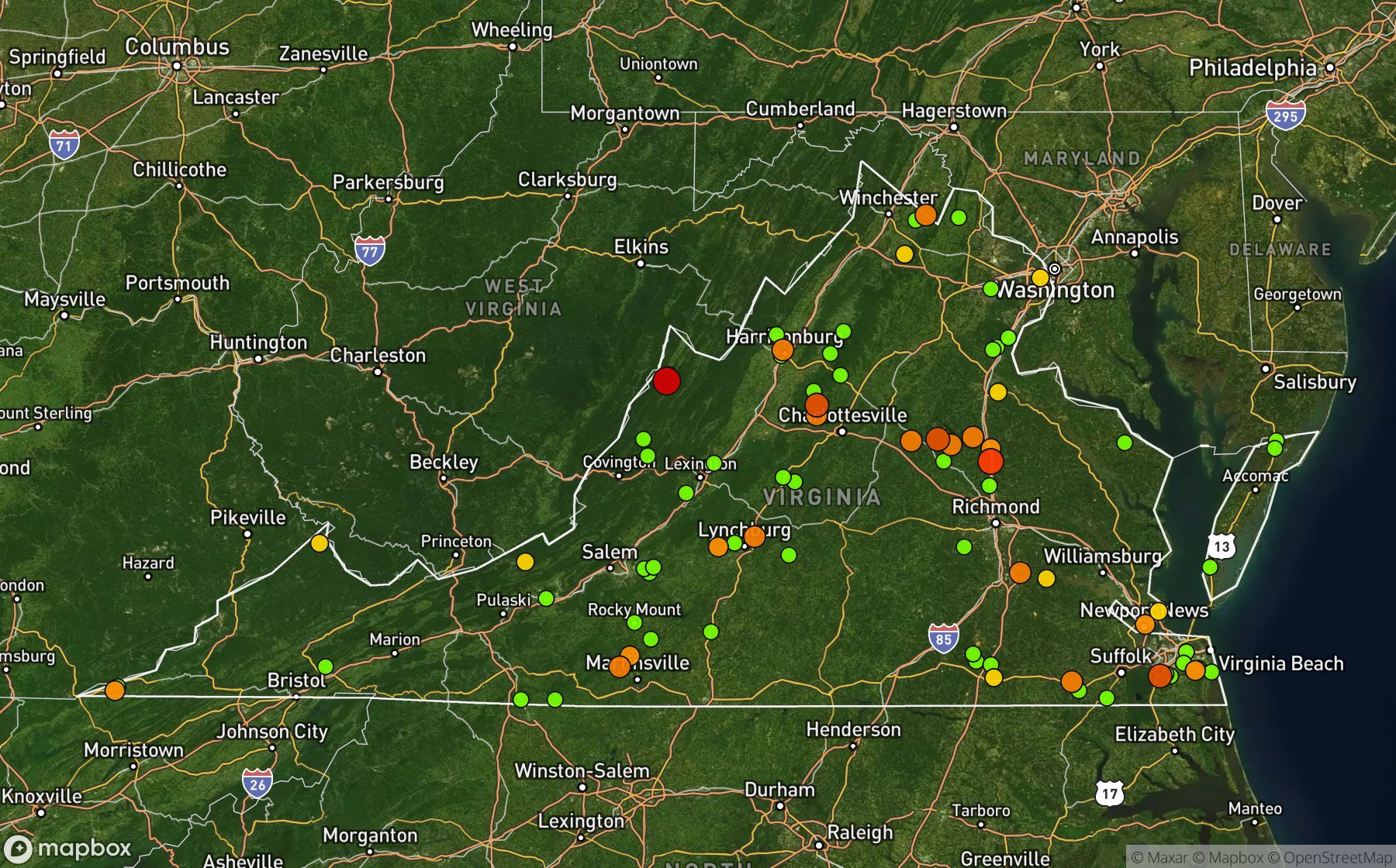
Largest NWS / NCEI hail reports across Virginia. Dot size and color show hail size.
Recent hail days in Virginia
| Date | Peak hail | Radar estimate | NWS reports |
|---|---|---|---|
| Sep 26, 2026 | 2.25″ | 2.25″ | — |
| Sep 22, 2026 | 1.00″ | 1.00″ | — |
| Sep 21, 2026 | 1.75″ | 1.75″ | — |
| Sep 20, 2026 | 0.75″ | 0.75″ | — |
| Sep 19, 2026 | 0.75″ | 0.75″ | — |
| Sep 18, 2026 | 0.75″ | 0.75″ | — |
| Sep 11, 2026 | 0.75″ | 0.75″ | — |
| Sep 6, 2026 | 0.75″ | 0.75″ | — |
| Sep 5, 2026 | 1.25″ | 1.25″ | — |
| Sep 4, 2026 | 1.75″ | 1.75″ | — |
| Sep 3, 2026 | 1.75″ | 1.75″ | — |
| Sep 2, 2026 | 2.00″ | 2.00″ | — |
| Aug 30, 2026 | 0.75″ | 0.75″ | — |
| Aug 29, 2026 | 0.75″ | 0.75″ | — |
| Aug 28, 2026 | 1.25″ | 1.25″ | — |
| Aug 27, 2026 | 1.25″ | 1.25″ | — |
| Aug 23, 2026 | 1.25″ | 1.25″ | — |
| Aug 22, 2026 | 1.25″ | 1.25″ | — |
| Aug 20, 2026 | 1.00″ | 1.00″ | — |
| Aug 17, 2026 | 1.25″ | 1.25″ | — |
| Aug 16, 2026 | 1.00″ | 1.00″ | — |
| Aug 15, 2026 | 0.75″ | 0.75″ | — |
| Aug 14, 2026 | 3.50″ | 3.50″ | — |
| Aug 13, 2026 | 1.00″ | 1.00″ | — |
| Aug 11, 2026 | 1.50″ | 1.50″ | — |
Most hail-hit cities
Stewartsville (6), Forest (4), Lyh Ivy Hill Arpt (3), Princess Anne (3), Appomattox (2), Berryville (2), Camden Mills (2), Farmville Muni Arpt (2), Harrisonburg (2), Lynchburg (2), Mountain View (2), Mustoe (2)
Hail history for every Virginia city (120)
(Hsp)Ingalls Fld Hot(Phf)Newport NewsAmpt HillAppomattoxAquaArringtonAshlandBaileys XrdsBassettBeachBerryvilleBlue Ridge FarmsBoonesvilleBoonsboroBuchananBumpassBurrowsvilleCallaoCambriaCamden MillsCanaCarters MillsCavetownCheritonChilesburgChurchvilleCliffordCliftonCokeCornwallCurdsvilleDeltavilleDoswellElmaEwingFarmville Muni ArptForestFranklinFrederick HallFurnaceGainesvilleGalts MillGarrisonvilleGolansvilleGoshenGrassfieldGreen BayGretnaHamilton CrossingHamptonHardyHarrisonburgHenryHolladayHopewellHot SpgsHouchinsHurleyIrisburgJarrattLocust CreekLouisaLovingstonLydiaLyh Ivy Hill ArptLynchburgMarksvilleMc Lims StoreMerrimacMilldaleMontgomeryMoonlightMountain FallsMountain ViewMountcastleMountfairMustoeNatural BridgeNellysfordNew ChurchOak GroveOak HillOral OaksOyster PtPeaksvillePembrokePowells XrdsPrince GeorgePrincess AnneProffitPurdyRichardsvilleRocky MtRuther GlenShady GroveSigmaSmiths StoreSontagSparkling SpgsSperryvilleSpout SpgStewartsvilleStony PtStoryThoroughfareTriangleUpper ZionVickerWaterfallWellfordWest Gate Of LomondWhaleyWheatlandWhite HallWhite MarshWhite MillWinchesterWinterpockWoods CornerWorsham
Data window: NOAA MRMS radar hail swaths Oct 2021 – Nov 2026; NWS / NCEI Storm Events reports Nov 2024 – Jul 2026; CoCoRaHS volunteer reports Oct 2021 – present. Radar hail sizes are NOAA MRMS Maximum Estimated Size of Hail (MESH) and are estimates, not ground truth.