Hail Magic › Hail maps › West Virginia
◆ WEST VIRGINIA HAIL HISTORY
West Virginia hail map & storm history
West Virginia has recorded 237 hail days in the past 5 years, with hail up to 6.00″ (Softball). Most recent: Oct 27, 2026. Browse 118 cities with hail reports.
✓ Data compiled by a degreed meteorologist from NOAA & NWS sources
237Hail days in the past 5 years
2.25″Largest ground report · Green Bottom, Apr 14, 2025
6.00″Largest radar-estimated hail
118Cities with hail reports
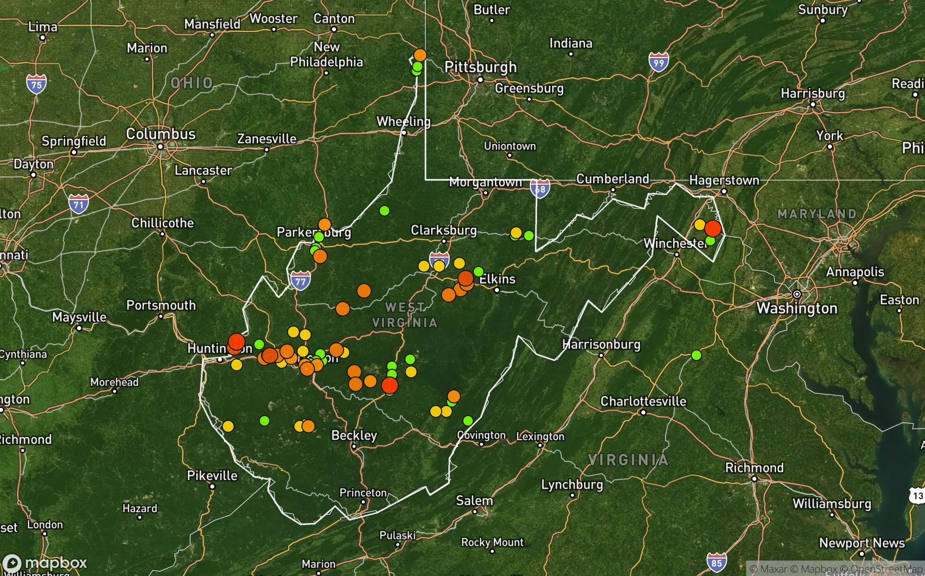
Largest NWS / NCEI hail reports across West Virginia. Dot size and color show hail size.
Recent hail days in West Virginia
| Date | Peak hail | Radar estimate | NWS reports |
|---|---|---|---|
| Oct 27, 2026 | 1.25″ | 1.25″ | — |
| Sep 22, 2026 | 1.50″ | 1.50″ | — |
| Sep 21, 2026 | 1.50″ | 1.50″ | — |
| Sep 17, 2026 | 0.75″ | 0.75″ | — |
| Sep 14, 2026 | 1.00″ | 1.00″ | — |
| Sep 13, 2026 | 0.75″ | 0.75″ | — |
| Sep 5, 2026 | 1.00″ | 1.00″ | — |
| Sep 4, 2026 | 1.50″ | 1.50″ | — |
| Sep 3, 2026 | 1.50″ | 1.50″ | — |
| Sep 2, 2026 | 1.00″ | 1.00″ | — |
| Aug 28, 2026 | 1.00″ | 1.00″ | — |
| Aug 27, 2026 | 1.50″ | 1.50″ | — |
| Aug 22, 2026 | 2.50″ | 2.50″ | — |
| Aug 17, 2026 | 1.00″ | 1.00″ | — |
| Aug 16, 2026 | 1.00″ | 1.00″ | — |
| Aug 14, 2026 | 0.75″ | 0.75″ | — |
| Aug 11, 2026 | 1.00″ | 1.00″ | — |
| Aug 10, 2026 | 1.75″ | 1.75″ | — |
| Aug 9, 2026 | 0.75″ | 0.75″ | — |
| Aug 8, 2026 | 1.00″ | 1.00″ | — |
| Aug 7, 2026 | 1.00″ | 1.00″ | — |
| Aug 6, 2026 | 0.75″ | 0.75″ | — |
| Aug 5, 2026 | 1.00″ | 1.00″ | — |
| Aug 4, 2026 | 0.75″ | 0.75″ | — |
| Aug 2, 2026 | 1.00″ | 1.00″ | — |
Most hail-hit cities
Mt Vernon (4), Williamstown (4), New Cumberland (3), (Crw) Yeager Arpt (2), Almoris (2), Beaver (2), Bellmont (2), Chapmanville (2), Charles Town (2), Craigsville (2), Fairview (2), Freemansburg (2)
Hail history for every West Virginia city (118)
(Crw) Yeager Arpt(Mrb)Shepherd Fld MrAlmorisArdelArroyoAuroraBaisdenBarlowBeaverBellmontBlue JayBlundonBonnivaleCapon BridgeChapmanvilleCharles TownCharlestonClementsClendeninCordovaCox LndgCraigsvilleCreedCrown CityCumberland HgtsDroopDuffieldsElkElkviewErbaconFair PlainFairviewFlaggy MeadowFreemansburgFrench CreekGaston JctGauley MillsGhentGoldenGoldtownGrantsvilleGreen BottomHarrisvilleHillsboroHodgesHomelandHurricaneIvyKennaKesling MillKitchenKohlsaatLesageLibertyLightburnLimestone HillLittle FallsLizemoresLockwoodMacomberMarlaing AdditionMarnieMarthaMc AlpinMc CauleyMiddlebourneMillstoneMineral Wells ArptMingoMt NeboMt OliveMt VernonMuddletyMyrtleNeolaNew CumberlandNew EnglandNewarkNewellNorth RavenswoodOpen Fork JctParkersburgPeeltreePennsboroPettyvillePhillipi Sampson ArpPinchPipestemPocaPocatalicoPughtownQueen ShoalsRaymond CityRidgewayRowlesburgRutledgeSanduskyScott DepotSissonvilleSouth ParkSouth RuffnerSpring HillStewartStonecoalSumercoSummersvilleSummersville ArptTiogaTripletTwilightUffingtownVeganViennaVioletWatsonWest CharlestonWilliamstownWilsondale
Data window: NOAA MRMS radar hail swaths Oct 2021 – Nov 2026; NWS / NCEI Storm Events reports Nov 2024 – Jul 2026; CoCoRaHS volunteer reports Oct 2021 – present. Radar hail sizes are NOAA MRMS Maximum Estimated Size of Hail (MESH) and are estimates, not ground truth.