Hail Magic › Hail maps › Georgia
◆ GEORGIA HAIL HISTORY
Georgia hail map & storm history
Georgia has recorded 535 hail days in the past 5 years, with hail up to 5.00″ (Softball). Most recent: Oct 10, 2026. Browse 124 cities with hail reports.
✓ Data compiled by a degreed meteorologist from NOAA & NWS sources
535Hail days in the past 5 years
2.50″Largest ground report · Woodstock, Apr 11, 2025
5.00″Largest radar-estimated hail
124Cities with hail reports
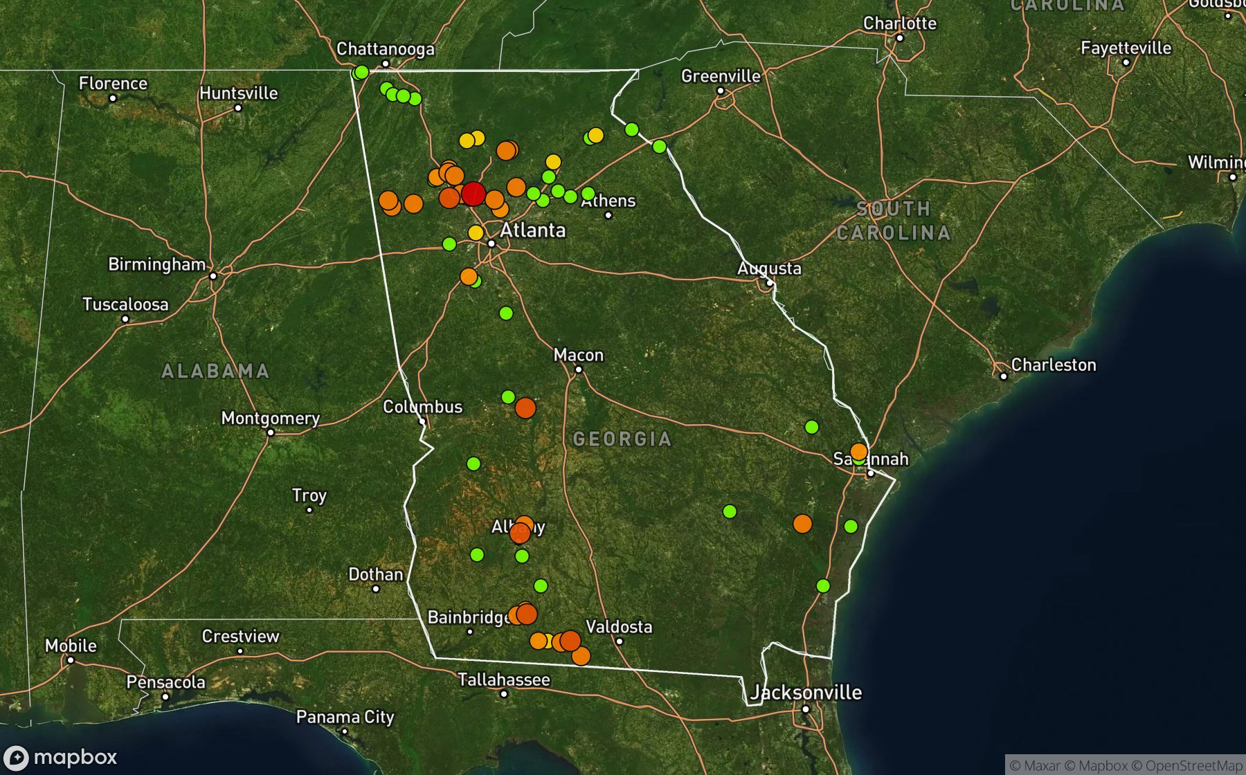
Largest NWS / NCEI hail reports across Georgia. Dot size and color show hail size.
Recent hail days in Georgia
| Date | Peak hail | Radar estimate | NWS reports |
|---|---|---|---|
| Oct 10, 2026 | 1.00″ | 1.00″ | — |
| Oct 3, 2026 | 1.25″ | 1.25″ | — |
| Sep 23, 2026 | 0.75″ | 0.75″ | — |
| Sep 22, 2026 | 1.25″ | 1.25″ | — |
| Sep 21, 2026 | 1.75″ | 1.75″ | — |
| Sep 20, 2026 | 1.75″ | 1.75″ | — |
| Sep 19, 2026 | 1.50″ | 1.50″ | — |
| Sep 13, 2026 | 0.75″ | 0.75″ | — |
| Sep 11, 2026 | 1.00″ | 1.00″ | — |
| Sep 7, 2026 | 1.25″ | 1.25″ | — |
| Sep 6, 2026 | 1.75″ | 1.75″ | — |
| Sep 5, 2026 | 1.75″ | 1.75″ | — |
| Aug 30, 2026 | 0.75″ | 0.75″ | — |
| Aug 29, 2026 | 0.75″ | 0.75″ | — |
| Aug 28, 2026 | 0.75″ | 0.75″ | — |
| Aug 27, 2026 | 1.00″ | 1.00″ | — |
| Aug 26, 2026 | 0.75″ | 0.75″ | — |
| Aug 25, 2026 | 1.50″ | 1.50″ | — |
| Aug 24, 2026 | 1.25″ | 1.25″ | — |
| Aug 23, 2026 | 0.75″ | 0.75″ | — |
| Aug 22, 2026 | 0.75″ | 0.75″ | — |
| Aug 21, 2026 | 1.75″ | 1.75″ | — |
| Aug 20, 2026 | 1.75″ | 1.75″ | — |
| Aug 19, 2026 | 1.25″ | 1.25″ | — |
| Aug 18, 2026 | 1.00″ | 1.00″ | — |
Most hail-hit cities
Oak Grove (6), Roswell (4), White (4), Cole City (3), Quality (3), Reynolds (3), Woodstock (3), Birmingham (2), Boston (2), Cass (2), Cedartown (2), Cornelia (2)
Hail history for every Georgia city (124)
AlapahaAllatoonaAllenvilleArdenAshburnAtlanta Hartsfield IBaxleyBayviewBeachtonBirminghamBluestoneBoltonBostonBraseltonCamillaCarns MillCassCedartownCenturyChestateeChickamaugaClaytonCole CityCorneliaCrabappleCrowvilleDixieDock JctDouglasvilleEast PtElpinoEmitEnonExleyFairviewFarmvilleFaulkvilleFickling MillFishForest ParkForresterGnesville Cotton MilGrassdaleGriffinGuytonHartwellHephzibahHog MtnHolly SpgsHomestead ParkHubbardsvilleJeffersonJunoKellerKingslandLanierLearyLeefieldLees MillLelandLookout MtnLumpkinMarblehillMarietta Mccolum ArpMars Hill CrossroadsMasseeMc CallieMeinhardMetterMolenaMount VernonMt AiryNevilsNew SwitzerlandNewarkNewtownNorcrossNorth ElbertonOak GroveOakdaleOaklawnOakwoodPaynePhilemaPine ValleyPoplar Arbor ChurchPrestonPutneyPyles MarshQualityRavenelRed OakReed CreekRentzReynoldsRoberRock SpgRoswellRoystonRudenScarecornSeabrookSellsSilk MillsSouth MoultrieSpenceSpence FieldSpring PlaceStocksStopSugar HillSummervilleTalking RockTempleThomasvilleToccoaVancevilleVictoriaWacoWagon WheelWenonaWhiteWood StationWoodstock
Data window: NOAA MRMS radar hail swaths Oct 2021 – Nov 2026; NWS / NCEI Storm Events reports Nov 2024 – Jul 2026; CoCoRaHS volunteer reports Oct 2021 – present. Radar hail sizes are NOAA MRMS Maximum Estimated Size of Hail (MESH) and are estimates, not ground truth.