◆ CHESTATEE, GA HAIL HISTORY · FORSYTH COUNTY
Chestatee, GA hail history & hail map
Chestatee, Georgia has had 2 hail events in the past 5 years, with hail up to 1.00″ (Quarter). Most recent: Jun 26, 2025. Free hail map, storm dates and NWS/CoCoRaHS reports.
✓ Data compiled by a degreed meteorologist from NOAA & NWS sources
2Hail events in the past 5 years
1.00″Largest recorded hail · Quarter
1.00″Largest ground report (within 3 mi)
0.75″Largest radar-estimated hail
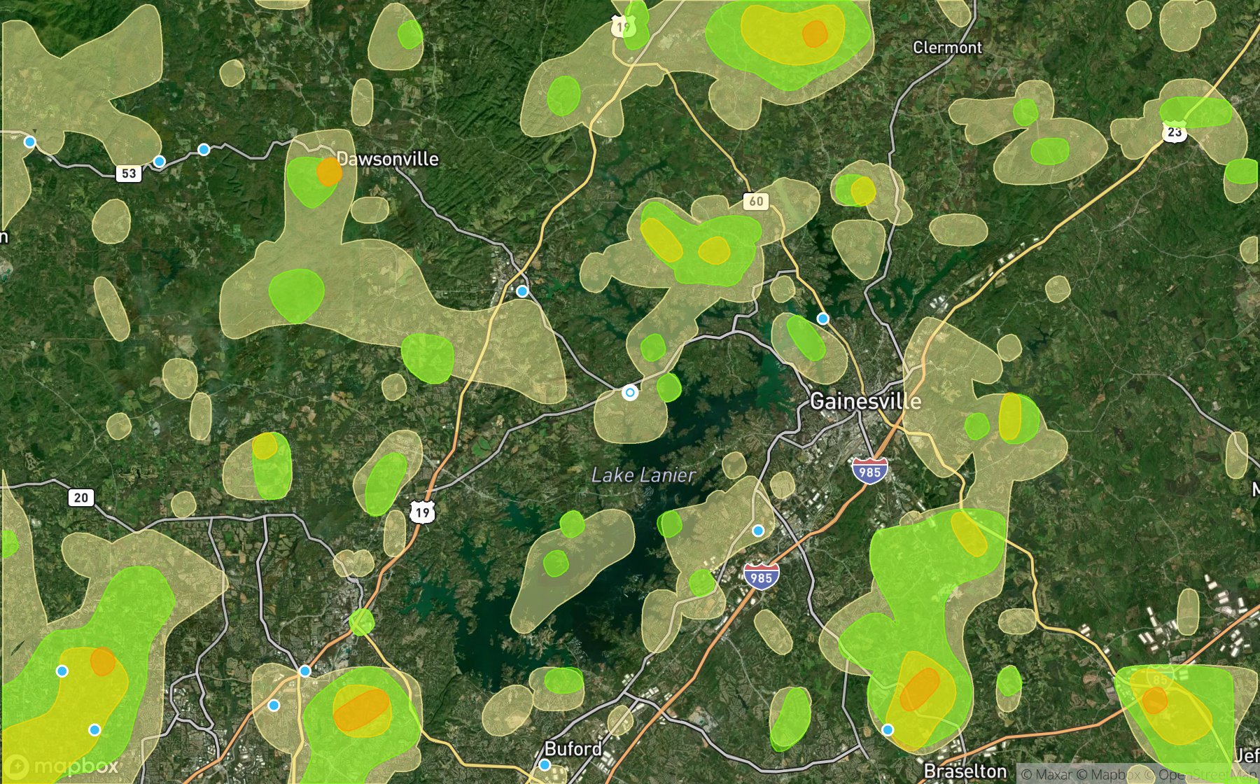
Radar hail swaths (NOAA MRMS MESH) in the past 5 years over Chestatee, shaded by hail size; blue dots are ground reports.
Recent hail storm dates in Chestatee
| Date | Peak hail | Sources |
|---|---|---|
| Jun 26, 2025 | 0.75″ Penny | Radar 0.75″ |
| Apr 10, 2025 | 1.00″ Quarter | 1 ground report (max 1.00″) |
More Georgia hail history
All Georgia cities & hail days →
Events count days with NOAA MRMS radar hail over Chestatee (34.302, -83.969) or an NWS / CoCoRaHS hail report within 3 miles. Data window: NOAA MRMS radar hail swaths Oct 2021 – Nov 2026; NWS / NCEI Storm Events reports Nov 2024 – Jul 2026; CoCoRaHS volunteer reports Oct 2021 – present. Radar hail sizes are estimates, not ground truth; hail at any single address can differ.